Highway 37 gets its $500 million interim fix. The long game against the bay is still unfunded
Construction is underway on the Sears Point to Mare Island widening, with HOV lanes and habitat restoration. An elevated highway above the rising bay remains a plan without money.

SAN PABLO BAY: The most flood-prone highway in the Bay Area is finally getting rebuilt, and the rebuild admits, in its own engineering, that it is only buying time.
The estimated $500 million project to widen Highway 37 between Sears Point and Mare Island entered construction this year, adding high-occupancy vehicle lanes that will operate as tolled express lanes, alongside habitat restoration around the corridor. The governor signed legislation paving the way for the upgrades, which state and regional agencies have framed as the interim answer to a corridor that already closes when the bay pushes over its shoulders.
The interim project is real progress on a road that carries commuters between Marin, Sonoma, Solano and Napa counties across some of the lowest-lying highway miles in California. The widening adds capacity, the express lanes add a managed option for carpools and paying drivers, and the restoration work returns marshland the original highway helped degrade.
But every document behind the project says the same thing: the corridor's long-term future is an elevated highway above a rising bay, and that project has no funding. The Bay Conservation and Development Commission's briefing materials and the Metropolitan Transportation Commission's feasibility work describe a phased strategy in which the interim widening stabilizes the corridor for the coming decades while the region figures out how to pay for a resilient, elevated replacement.
A corridor, not just a commute
Highway 37 is the North Bay's east-west spine: the route from Marin and Sonoma to Interstate 80, to Sacramento, to the Central Valley's jobs. When it floods, the detour adds an hour. When it congests, which is daily, it bleeds into every parallel route.
The tolled express lanes are the project's financial logic as well as its traffic logic. Toll revenue from the lanes helps finance the corridor, a model the region has already applied on other congested freeways. For drivers, the question is the familiar one: whether the free lanes move better once the paying lanes siphon off the carpools and the time-pressed.
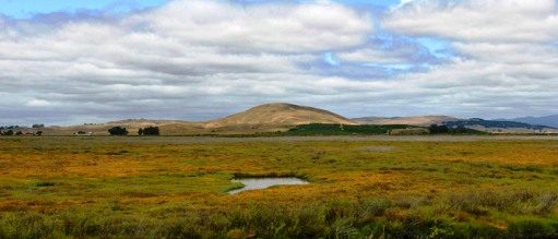
The habitat side of the project may prove as durable as the asphalt. Restoring tidal marsh along the corridor does double duty: it rebuilds the estuary the bay needs, and marshland is itself flood infrastructure, absorbing the storm surge that now reaches the roadway.
The honest framing, the one the agencies use when they are not selling, is that the North Bay is building a bridge to a bridge: an interim highway to carry the next twenty years of commuters while the region assembles the billions for the elevated corridor the bay will eventually require. The first span is under construction. The second exists only on paper.
None to date. The Tribune corrects errors promptly and transparently. Read our corrections policy.